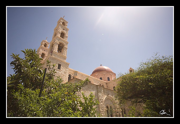
| ... a oni (vědomi si své historie) obecně nemají žádný problém s tím, že mimo nich některá místa považují za svatá křesťani nebo muslimové (jako např. u Chrámové hory, kterou když v roce 1967 dobyli, tak ji téměř ihned dali do správy muslimů). |
| 3 GPS 29. 06. 2010 11:09:49, Izrael - Shekem (Nablus), 1/1000 sec, f 6.3, ISO 200 , 12 mm, Blesk No Flash |
Cesta
2010/06 cerven/29 Samari a Shekem-Nablus/20100629-044.jpgContains Exchangeable Image File Format (EXIF) Information
Main Image Information
| Image Width | 682 pixels |
| Image Length | 472 pixels |
| Compression | Uncompressed |
| Photometric Interpretation | RGB (Red Green Blue) |
| Make (Manufacturer) | Canon |
| Model | Canon EOS 40D |
| X Resolution | 1207959552/16777216 (72) pixels per 'Resolution Unit' |
| Y Resolution | 1207959552/16777216 (72) pixels per 'Resolution Unit' |
| Planar Configuration | Chunky Format |
| Resolution Unit | Inches |
| Date and Time | 2010:07:09 12:08:04 (Format: YYYY:MM:DD HH:mm:SS) |
| YCbCr Positioning | Chrominance components Centred in relation to luminance components |
EXIF Image File Directory (IFD) contents
| Exposure Time | 1/1000 (0.001) seconds |
| Aperture F Number | 63/10 (6.3) |
| Exposure Program | Aperture priority |
| ISO Speed Ratings | 200 |
| Exif Version | 0221 |
| Date and Time of Original | 2010:06:29 11:09:49 |
| Date and Time when Digitized | 2010:06:29 11:09:49 |
| APEX Shutter Speed Value (Tv) | 9965784/1000000 (9.965784) |
| APEX Aperture Value (Av) | 5310704/1000000 (5.310704) |
| APEX Exposure Bias Value (Exposure Compensation) | 0/1 (0) EV |
| Metering Mode | Pattern |
| Flash | Flash did not fire, compulsory flash suppression mode |
| FocalLength | 12/1 (12) mm |
| Sub Second Time of Original | 41 |
| Sub Second Time when Digitized | 41 |
| Focal Plane X Resolution | 3888000/876 (4438.3561643836) pixels per 'Focal Plane Resolution Unit' |
| Focal Plane Y Resolution | 2592000/583 (4445.9691252144) pixels per 'Focal Plane Resolution Unit' |
| Focal Plane Resolution Unit | Inches |
| Special Processing (Custom Rendered) | Normal process |
| Exposure Mode | Auto exposure |
| White Balance | Manual white balance |
| Scene Capture Type | Standard |
| Pixel X Dimension | 682 pixels |
| Pixel Y Dimension | 472 pixels |
| Colour Space | Uncalibrated |
| Components Configuration | Component 1: Y (Luminance) Component 2: Cb (Chroma minus Blue) Component 3: Cr (Chroma minus Red) Component 4: Does not exist |
| User Comment |
GPS Info Image File Directory (IFD) contents
| Longitude | 35/1 (35), 1710282/100000 (17.10282), 0/0 (Degrees Minutes Seconds East or West) |
| East or West Longitude | E |
| Latitude | 32/1 (32), 1256418/100000 (12.56418), 0/0 (Degrees Minutes Seconds North or South) |
| North or South Latitude | N |
| Altitude | 513000/1000 (513) Metres with respect to Altitude Reference |
| Altitude Reference | Sea Level |
Contains Extensible Metadata Platform (XMP) / Resource Description Framework (RDF) Information
Dublin Core Metadata Initiative RDF Segment
| Creator(s) (Authors): | Ordered List: Ing. Daniel Žingor |
| Rights Statement: | List of Alternates: © Daniel Žingor |
| Subject and Keywords: | Unordered List: Architektura Reportáž Web |
| Description (Caption): | List of Alternates: ... a oni (vědomi si své historie) obecně nemají žádný problém s tím, že mimo nich některá místa považují za svatá křesťani nebo muslimové (jako např. u Chrámové hory, kterou když v roce 1967 dobyli, tak ji téměř ihned dali do správy muslimů). |
XMP - embedded TIFF Segment
| Make: | Canon |
| Model: | Canon EOS 40D |
| Image Width: | 3888 |
| Image Length: | 2592 |
| Samples Per Pixel: | 3 |
| Bits Per Sample: | Ordered List: 16 16 16 |
| Photometric Interpretation: | 2 |
XMP - embedded EXIF Segment
| Exif Version: | 0221 |
| Exposure Time: | 1/1000 |
| Shutter Speed Value: | 9965784/1000000 |
| F Number: | 63/10 |
| Aperture Value: | 5310704/1000000 |
| Exposure Program: | 3 |
| Date & Time of Original: | 2010-06-29T11:09:49.41+02:00 |
| Date & Time Digitized: | 2010-06-29T11:09:49.41+02:00 |
| Exposure Bias Value: | 0/1 |
| Metering Mode: | 5 |
| Focal Length: | 12/1 |
| Custom Rendered: | 0 |
| Exposure Mode: | 0 |
| White Balance: | 1 |
| Scene Capture Type: | 0 |
| Focal Plane X Resolution: | 3888000/876 |
| Focal Plane Y Resolution: | 2592000/583 |
| Focal Plane Resolution Unit: | 2 |
| ISO Speed Ratings: | Ordered List: 200 |
| Flash: | Fired = False Return = 0 Mode = 2 Function = False Red Eye Mode = False |
| Pixel X Dimension: | 3888 |
| Pixel Y Dimension: | 2592 |
| GPS Longitude: | 35,17.102819E |
| GPS Latitude: | 32,12.564180N |
| GPS Altitude: | 513000/1000 |
| GPS Altitude Reference: | 0 |
XMP Basic Segment
| Resource Last Modify Date: | 2010-06-29T18:26:40+02:00 |
| Original Creation Date: | 2010-06-29T11:09:49.41+02:00 |
| Unknown field xap:Rating: | 3 |
| Unknown field xap:Label: | Green |
Unknown RDF Segment 'aux'
| Unknown field aux:Lens: | 10.00 - 20.00 mm |
| Unknown field aux:Firmware: | Firmware Version 1.0.3 |
Photoshop RDF Segment
| Unknown field photoshop:LegacyIPTCDigest: | EA20940AFBF52D322CB867DF2CB70E1C |
Unknown RDF Segment 'znr'
| Unknown field znr:RawDevelopSettings: | UEsDBBQAAAAIAFGT3TzSxoRX5QIAAKsJAAAMAAAAc2V0dGluZ3MueG1sbZZLbtswEIb3BXqHHiBO ZMVO6iAgELT7Au02G4Ya20QkUiApp85NeoieoIsuip6nVyglzfCleKX55udQnBmO/O/X7/tX83LX wAla3bP37ybzoTXAm/ND37cSGra+v3qDotYa0XN3ZJ/vHhv9PHSg3Pnxy5Phr8/nx7paV6vqZlXv PnzjHf/748/PiVU39W5VbTaXn77Wc3AKg1G5cXLPhdvL1oFhKCooalt5ODrLqlmDFr3dkTf6JTjJ RK/QyhluHbmDTf6WG+nOwY0meh10PRjuBgNse3t7PYtSSmF4l1KKllMKKpVjq48YazSSIKOZrE68 dgzCndSK+eziYSND1Un6uigBURMIKo5DeL/xEenLE0H/hGyvTccdw1Ojhb4GOm25FLQq2CHvrTa2 5yImIxKKL1vwHYm9hxb6BttZZ0AdfMPcYISURZnhjRwsW1/WUYYsitzRgD3qtqE+y1jUtUOnVXum d0oIauB7L3TXs+qS8ksEBcr4FXTm2Qgen4LoGY3YwqZXYNMmRkDpFj3DRIuwlW9kZcey0LIIUGG0 4w6ml0UJEqqS0b0B4WaF/12Eh3X5gFWkFaEPrJtuNbUBmrGFBDSKd8BCFxHI7rajWmyyS+6KEuHt XqhLnsV+akE1Vr4Cu82CR55HX+oXjiL+YBrpjzROrOtii8RV7vLGqrd82V5+IICy44jabNONIs93 WeoXjiw+nFidFTzgPO5CFzl1p1YgBnPylZ9M0etpuF1QsyIgOZp1vbuot9uF5iqPmY2Zo9w7lk6Z CaDkYPjZ+I8ZpZjsxH0wAIptd1Ewk0TiK+Jn6joqJhAEeuj9HNB2HPNBlMJU6SdsqokDdzKnE2SC mSw08ymrUlgc3uM4TdKoixkz0ZjhVLvI+0SVlhZ8Kgcxf5WSBYUr2yEMqWyHcnThgdQJjC2jJzhT +wtjeG/0+CnJF2SedM2xMfmfi4IW2uLPRolT9dgkVvAWMnGk1NPxj9l/UEsBAgAAFAAAAAgAUZPd PNLGhFflAgAAqwkAAAwAAAAAAAAAAQAgAAAAAAAAAHNldHRpbmdzLnhtbFBLBQYAAAAAAQABADoA AAAPAwAAAAA= |
Unknown RDF Segment 'Iptc4xmpCore'
| Unknown field Iptc4xmpCore:Location: | Izrael - Shekem (Nablus) |


