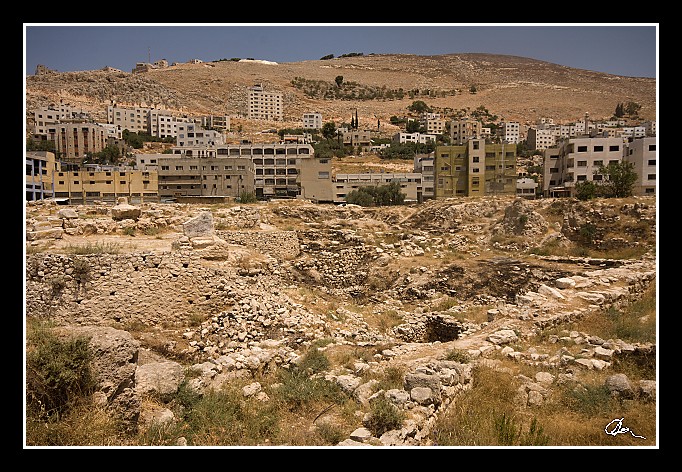
| ... a někam nás to táhnou ... "Židi prý prd ví o tom, kde je hrob Josefa" - ten pravý je prý tady ... |
| 3 GPS 29. 06. 2010 11:39:02, Izrael - Shekem (Nablus), 1/320 sec, f 14, ISO 200 , 17 mm, Blesk No Flash |
Cesta
2010/06 cerven/29 Samari a Shekem-Nablus/20100629-058.jpgContains Exchangeable Image File Format (EXIF) Information
Main Image Information
| Image Width | 682 pixels |
| Image Length | 472 pixels |
| Compression | Uncompressed |
| Photometric Interpretation | RGB (Red Green Blue) |
| Make (Manufacturer) | Canon |
| Model | Canon EOS 40D |
| X Resolution | 1207959552/16777216 (72) pixels per 'Resolution Unit' |
| Y Resolution | 1207959552/16777216 (72) pixels per 'Resolution Unit' |
| Planar Configuration | Chunky Format |
| Resolution Unit | Inches |
| Date and Time | 2010:07:09 12:08:10 (Format: YYYY:MM:DD HH:mm:SS) |
| YCbCr Positioning | Chrominance components Centred in relation to luminance components |
EXIF Image File Directory (IFD) contents
| Exposure Time | 1/320 (0.003125) seconds |
| Aperture F Number | 14/1 (14) |
| Exposure Program | Aperture priority |
| ISO Speed Ratings | 200 |
| Exif Version | 0221 |
| Date and Time of Original | 2010:06:29 11:39:02 |
| Date and Time when Digitized | 2010:06:29 11:39:02 |
| APEX Shutter Speed Value (Tv) | 8321928/1000000 (8.321928) |
| APEX Aperture Value (Av) | 761471/100000 (7.61471) |
| APEX Exposure Bias Value (Exposure Compensation) | 0/1 (0) EV |
| Metering Mode | Pattern |
| Flash | Flash did not fire, compulsory flash suppression mode |
| FocalLength | 17/1 (17) mm |
| Sub Second Time of Original | 29 |
| Sub Second Time when Digitized | 29 |
| Focal Plane X Resolution | 3888000/876 (4438.3561643836) pixels per 'Focal Plane Resolution Unit' |
| Focal Plane Y Resolution | 2592000/583 (4445.9691252144) pixels per 'Focal Plane Resolution Unit' |
| Focal Plane Resolution Unit | Inches |
| Special Processing (Custom Rendered) | Normal process |
| Exposure Mode | Auto exposure |
| White Balance | Manual white balance |
| Scene Capture Type | Standard |
| Pixel X Dimension | 682 pixels |
| Pixel Y Dimension | 472 pixels |
| Colour Space | Uncalibrated |
| Components Configuration | Component 1: Y (Luminance) Component 2: Cb (Chroma minus Blue) Component 3: Cr (Chroma minus Red) Component 4: Does not exist |
| User Comment |
GPS Info Image File Directory (IFD) contents
| Longitude | 35/1 (35), 1692630/100000 (16.9263), 0/0 (Degrees Minutes Seconds East or West) |
| East or West Longitude | E |
| Latitude | 32/1 (32), 1279177/100000 (12.79177), 0/0 (Degrees Minutes Seconds North or South) |
| North or South Latitude | N |
| Altitude | 533190/1000 (533.19) Metres with respect to Altitude Reference |
| Altitude Reference | Sea Level |
Contains Extensible Metadata Platform (XMP) / Resource Description Framework (RDF) Information
Dublin Core Metadata Initiative RDF Segment
| Creator(s) (Authors): | Ordered List: Ing. Daniel Žingor |
| Rights Statement: | List of Alternates: © Daniel Žingor |
| Subject and Keywords: | Unordered List: Krajina Architektura Reportáž Web |
| Description (Caption): | List of Alternates: ... a někam nás to táhnou ... "Židi prý prd ví o tom, kde je hrob Josefa" - ten pravý je prý tady ... |
XMP - embedded TIFF Segment
| Make: | Canon |
| Model: | Canon EOS 40D |
| Image Width: | 3888 |
| Image Length: | 2592 |
| Samples Per Pixel: | 3 |
| Bits Per Sample: | Ordered List: 16 16 16 |
| Photometric Interpretation: | 2 |
XMP - embedded EXIF Segment
| Exif Version: | 0221 |
| Exposure Time: | 1/320 |
| Shutter Speed Value: | 8321928/1000000 |
| F Number: | 14/1 |
| Aperture Value: | 761471/100000 |
| Exposure Program: | 3 |
| Date & Time of Original: | 2010-06-29T11:39:02.29+02:00 |
| Date & Time Digitized: | 2010-06-29T11:39:02.29+02:00 |
| Exposure Bias Value: | 0/1 |
| Metering Mode: | 5 |
| Focal Length: | 17/1 |
| Custom Rendered: | 0 |
| Exposure Mode: | 0 |
| White Balance: | 1 |
| Scene Capture Type: | 0 |
| Focal Plane X Resolution: | 3888000/876 |
| Focal Plane Y Resolution: | 2592000/583 |
| Focal Plane Resolution Unit: | 2 |
| ISO Speed Ratings: | Ordered List: 200 |
| Flash: | Fired = False Return = 0 Mode = 2 Function = False Red Eye Mode = False |
| Pixel X Dimension: | 3888 |
| Pixel Y Dimension: | 2592 |
| GPS Longitude: | 35,16.926300E |
| GPS Latitude: | 32,12.791770N |
| GPS Altitude: | 533190/1000 |
| GPS Altitude Reference: | 0 |
XMP Basic Segment
| Resource Last Modify Date: | 2010-06-29T18:30:08+02:00 |
| Original Creation Date: | 2010-06-29T11:39:02.29+02:00 |
| Unknown field xap:Rating: | 3 |
| Unknown field xap:Label: | Green |
Unknown RDF Segment 'aux'
| Unknown field aux:Lens: | 10.00 - 20.00 mm |
| Unknown field aux:Firmware: | Firmware Version 1.0.3 |
Photoshop RDF Segment
| Unknown field photoshop:LegacyIPTCDigest: | EA20940AFBF52D322CB867DF2CB70E1C |
Unknown RDF Segment 'znr'
| Unknown field znr:RawDevelopSettings: | UEsDBBQAAAAIAMGT3Twd9NzP5QIAAKsJAAAMAAAAc2V0dGluZ3MueG1sbZZLbtwwDIb3BXqHHiCT epxMXggEBO2+QLvNRpE5YyG2ZEjypJOb9BA9QRddFD1Pr1DZJvVyZmV+/EVZJEXPv1+/71/Ny10D R+j0wN6/m82HzgBvTg/D0Elo2Pb+4xsUtdaIgbuWfb57bPTz2INyp8cvT4a/Pp8e62pbbaqrTX37 4Rvv+d8ff37OrLqqbzfV7ub809d6CU5hMCo3Tu65cHvZOTAMRQVFbScPrbOsWjRo0du1vNEvwUkm eoVWznDryB1s8nfcSHcKbjTR66AfwHA3GmC76+uLRZRSCsP7lFK0nFJQqRzb3GCsyUiCTGayOvHa KQh3Uivms4uHjQxVR+nrogRETSCoaMfwftMj0pcngv4J2V6bnjuGp0YLfQ302nIpaFWwQ947bezA RUxGJBRfduA7EnsPLfSNtrfOgDr4hrnCCCmLMsMbOVq2Pa+jDFkUudaAbXXXUJ9lLOq6sdeqO9E7 JQQ18H0Quh9YdU75JYICZfwKOvNiBI9PQfRMRmxhMyiwaRMjoHSLgWGiRdjKN7KyU1loWQSoMNpx B/PLogQJVcnowYBwi8L/zsLDtnzAKtKK0AfWzbea2gDN2EICGsV7YKGLCGR321EtLrNL7ooS4e1e qUuexX7qQDVWvgK7zoJHnkdf61eOIv5oGumPNE2si2KLxFXu8saqt3zZXn4ggLLTiLrcpRtFnu+y 1q8cWXw4sjoreMB53JUucupOrUCM5ugrP5ti0PNwO6NmRUByNOuLi7N6t1tpPuYxszHTyr1j6ZSZ AUoOhp+M/5hRislO3AcDoNjuNgoWkkh8RfxM3UbFDIJAj4OfA9pOYz6IUpgq/YRNNXHgzuZ8gkyw kJVmOWVVCovDexynSRp1NWNmGjOcald5n6nS0oJP5SiWr1KyoHBlO4Qhle1Qji48kDqCsWX0BGdq f2EMH4yePiX5gsyTrmkbk/+5KGihLf5slDhVT01iBe8gE0dKPR3/mP0HUEsBAgAAFAAAAAgAwZPd PB303M/lAgAAqwkAAAwAAAAAAAAAAQAgAAAAAAAAAHNldHRpbmdzLnhtbFBLBQYAAAAAAQABADoA AAAPAwAAAAA= |
Unknown RDF Segment 'Iptc4xmpCore'
| Unknown field Iptc4xmpCore:Location: | Izrael - Shekem (Nablus) |


