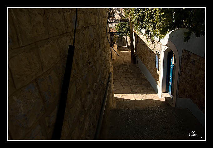
| Prý snad "město na hoře ležící" z Matouše 5 a 6 .... |
| 2 GPS 27. 06. 2010 16:21:16, Izrael - Safed, 1/1000 sec, f 4.5, ISO 200 , 17 mm, Blesk No Flash |
Cesta
2010/06 cerven/27 Galilea, Golany a plavba/20100627-064.jpgContains Exchangeable Image File Format (EXIF) Information
Main Image Information
| Image Width | 682 pixels |
| Image Length | 472 pixels |
| Compression | Uncompressed |
| Photometric Interpretation | RGB (Red Green Blue) |
| Make (Manufacturer) | Canon |
| Model | Canon EOS 40D |
| X Resolution | 1207959552/16777216 (72) pixels per 'Resolution Unit' |
| Y Resolution | 1207959552/16777216 (72) pixels per 'Resolution Unit' |
| Planar Configuration | Chunky Format |
| Resolution Unit | Inches |
| Date and Time | 2010:07:08 10:31:46 (Format: YYYY:MM:DD HH:mm:SS) |
| YCbCr Positioning | Chrominance components Centred in relation to luminance components |
EXIF Image File Directory (IFD) contents
| Exposure Time | 1/1000 (0.001) seconds |
| Aperture F Number | 45/10 (4.5) |
| Exposure Program | Aperture priority |
| ISO Speed Ratings | 200 |
| Exif Version | 0221 |
| Date and Time of Original | 2010:06:27 16:21:16 |
| Date and Time when Digitized | 2010:06:27 16:21:16 |
| APEX Shutter Speed Value (Tv) | 9965784/1000000 (9.965784) |
| APEX Aperture Value (Av) | 433985/100000 (4.33985) |
| APEX Exposure Bias Value (Exposure Compensation) | -1/3 (-0.33333333333333) EV |
| Metering Mode | Pattern |
| Flash | Flash did not fire, compulsory flash suppression mode |
| FocalLength | 17/1 (17) mm |
| Sub Second Time of Original | 25 |
| Sub Second Time when Digitized | 25 |
| Focal Plane X Resolution | 3888000/876 (4438.3561643836) pixels per 'Focal Plane Resolution Unit' |
| Focal Plane Y Resolution | 2592000/583 (4445.9691252144) pixels per 'Focal Plane Resolution Unit' |
| Focal Plane Resolution Unit | Inches |
| Special Processing (Custom Rendered) | Normal process |
| Exposure Mode | Auto exposure |
| White Balance | Manual white balance |
| Scene Capture Type | Standard |
| Pixel X Dimension | 682 pixels |
| Pixel Y Dimension | 472 pixels |
| Colour Space | Uncalibrated |
| Components Configuration | Component 1: Y (Luminance) Component 2: Cb (Chroma minus Blue) Component 3: Cr (Chroma minus Red) Component 4: Does not exist |
| User Comment |
GPS Info Image File Directory (IFD) contents
| Longitude | 35/1 (35), 2964618/100000 (29.64618), 0/0 (Degrees Minutes Seconds East or West) |
| East or West Longitude | E |
| Latitude | 32/1 (32), 5794308/100000 (57.94308), 0/0 (Degrees Minutes Seconds North or South) |
| North or South Latitude | N |
| Altitude | 763420/1000 (763.42) Metres with respect to Altitude Reference |
| Altitude Reference | Sea Level |
Contains Extensible Metadata Platform (XMP) / Resource Description Framework (RDF) Information
Dublin Core Metadata Initiative RDF Segment
| Creator(s) (Authors): | Ordered List: Ing. Daniel Žingor |
| Rights Statement: | List of Alternates: © Daniel Žingor |
| Subject and Keywords: | Unordered List: Reportáž Architektura Web |
| Description (Caption): | List of Alternates: Prý snad "město na hoře ležící" z Matouše 5 a 6 .... |
XMP - embedded TIFF Segment
| Make: | Canon |
| Model: | Canon EOS 40D |
| Image Width: | 3888 |
| Image Length: | 2592 |
| Samples Per Pixel: | 3 |
| Bits Per Sample: | Ordered List: 16 16 16 |
| Photometric Interpretation: | 2 |
XMP - embedded EXIF Segment
| Exif Version: | 0221 |
| Exposure Time: | 1/1000 |
| Shutter Speed Value: | 9965784/1000000 |
| F Number: | 45/10 |
| Aperture Value: | 433985/100000 |
| Exposure Program: | 3 |
| Date & Time of Original: | 2010-06-27T16:21:16.25+02:00 |
| Date & Time Digitized: | 2010-06-27T16:21:16.25+02:00 |
| Exposure Bias Value: | -1/3 |
| Metering Mode: | 5 |
| Focal Length: | 17/1 |
| Custom Rendered: | 0 |
| Exposure Mode: | 0 |
| White Balance: | 1 |
| Scene Capture Type: | 0 |
| Focal Plane X Resolution: | 3888000/876 |
| Focal Plane Y Resolution: | 2592000/583 |
| Focal Plane Resolution Unit: | 2 |
| ISO Speed Ratings: | Ordered List: 200 |
| Flash: | Fired = False Return = 0 Mode = 2 Function = False Red Eye Mode = False |
| Pixel X Dimension: | 3888 |
| Pixel Y Dimension: | 2592 |
| GPS Longitude: | 35,29.646179E |
| GPS Latitude: | 32,57.943081N |
| GPS Altitude: | 763420/1000 |
| GPS Altitude Reference: | 0 |
XMP Basic Segment
| Resource Last Modify Date: | 2010-06-27T21:16:20+02:00 |
| Original Creation Date: | 2010-06-27T16:21:16.25+02:00 |
| Unknown field xap:Rating: | 2 |
| Unknown field xap:Label: | Green |
Unknown RDF Segment 'aux'
| Unknown field aux:Lens: | 17.00 - 50.00 mm |
| Unknown field aux:Firmware: | Firmware Version 1.0.3 |
Photoshop RDF Segment
| Unknown field photoshop:LegacyIPTCDigest: | EA20940AFBF52D322CB867DF2CB70E1C |
Unknown RDF Segment 'znr'
| Unknown field znr:RawDevelopSettings: | UEsDBBQAAAAIAAaq2zy2lLrf0wIAAHcJAAAMAAAAc2V0dGluZ3MueG1sbZbNbtswDMfvA/YOeYB+ OGmbYEUhoNiAHgfs3ItiM7FQWTIoOZ37ajvskfYKk23q083J/PMn0qIoOv/+/H36wPfHBi4gdc++ fpnNZ4nAm/G576WAhm2fbj9RiTVY99y27Mfja6Pfhg6UHV9/HpF/vI2vu2pbXVf7691h88KlkMCv Ni9acjVu+KaX/HLkM1PtdwfH3d98/7VbkvmwlIWjFSde25OQFpARVKjESnFurWHVwpDl37bljX4P Tm+St9bKIjfWu4Pt/ZKjsGNwk0leC10PyO2AwPaHu4cFSlUfhnep6qPlqg8qlGXXB4o1GUmQyUxW J14zBeFWaMVcdWmzUSPqItw5qRoiExQi2iG83/RI6vvRi+6JtJPGjlt2t+hkka+BThsuar8q2KHu UqPpeR2LERUf33WP61DqRbLIN5jOWAR1dg2zpwipFjHkjRgM297sIkZahGyLYFotG99nmRY5OXRa ydG/U6IQA7/7Wnc9q258fb1CgEK3wu95MYLHlSB6JiO2MPYKTNrEJPhy1z2jQtchlWtkZaZj8cui QARqyy3ML0sIKf6UUPcItV0I97sKD9vygU7Rrwh9YOx8q30bkBlbqIZG8Q5Y6CIvZHfb+rO4zy65 LY6IbveKLvUs9lGCaoz4AHbIgkc9j77mV44i/oCNcFuaJtZdkSJxlVk+WfWZL8vlBgIoM42o+4c0 UdTzLGt+5cjiw4XtsgMPch53xUXdd6dWUA948Scf7WxEtOJkWTohZoGQM/IR3YfJl8fbifuMAIo9 fIvAoiSIq6abh9tIzEIA9NC7O6zNNKIDlIop6aZjysRhOZvzDjJgUVbMssuqBIvNOzlOgjTqaj7M aqxwyq7qPqtKCwOulEO9fFGSBYUryxAGTJahHDu0IXUBNGX0RM5o1+zIe9TTZyBfkHnSNW2D+R+D Qi3Y4o9CKaf01CSm5hIyOKqOvc3/ZP0HUEsBAgAAFAAAAAgABqrbPLaUut/TAgAAdwkAAAwAAAAA AAAAAQAgAAAAAAAAAHNldHRpbmdzLnhtbFBLBQYAAAAAAQABADoAAAD9AgAAAAA= |
Unknown RDF Segment 'Iptc4xmpCore'
| Unknown field Iptc4xmpCore:Location: | Izrael - Safed |


