| Z okolních hor stékají proudy vod dolů a potom až do Mrtvého moře ... |
|
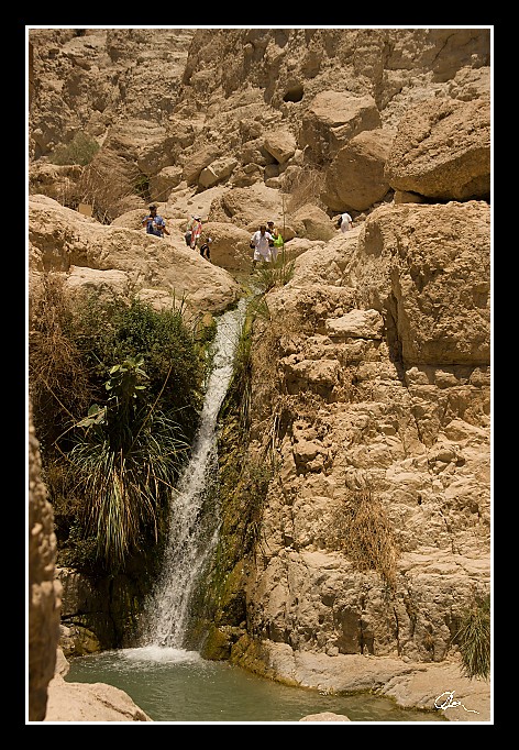
| 3 GPS 24. 06. 2010 12:10:32, Izrael - En Gedi, 1/800 sec, f 4, ISO 200 , 32 mm, Blesk No Flash |
Cesta
2010/06 cerven/24 Qumran, En Gedi a Wadi Quelt/20100624-032.jpgContains Exchangeable Image File Format (EXIF) Information
Main Image Information
| Image Width | 472 pixels |
| Image Length | 682 pixels |
| Compression | Uncompressed |
| Photometric Interpretation | RGB (Red Green Blue) |
| Make (Manufacturer) | Canon |
| Model | Canon EOS 40D |
| X Resolution | 1207959552/16777216 (72) pixels per 'Resolution Unit' |
| Y Resolution | 1207959552/16777216 (72) pixels per 'Resolution Unit' |
| Planar Configuration | Chunky Format |
| Resolution Unit | Inches |
| Date and Time | 2010:07:03 17:42:23 (Format: YYYY:MM:DD HH:mm:SS) |
| YCbCr Positioning | Chrominance components Centred in relation to luminance components |
EXIF Image File Directory (IFD) contents
| Exposure Time | 1/800 (0.00125) seconds |
| Aperture F Number | 4/1 (4) |
| Exposure Program | Aperture priority |
| ISO Speed Ratings | 200 |
| Exif Version | 0221 |
| Date and Time of Original | 2010:06:24 12:10:32 |
| Date and Time when Digitized | 2010:06:24 12:10:32 |
| APEX Shutter Speed Value (Tv) | 9643856/1000000 (9.643856) |
| APEX Aperture Value (Av) | 4/1 (4) |
| APEX Exposure Bias Value (Exposure Compensation) | 0/1 (0) EV |
| Metering Mode | Pattern |
| Flash | Flash did not fire, compulsory flash suppression mode |
| FocalLength | 32/1 (32) mm |
| Sub Second Time of Original | 33 |
| Sub Second Time when Digitized | 33 |
| Focal Plane X Resolution | 3888000/876 (4438.3561643836) pixels per 'Focal Plane Resolution Unit' |
| Focal Plane Y Resolution | 2592000/583 (4445.9691252144) pixels per 'Focal Plane Resolution Unit' |
| Focal Plane Resolution Unit | Inches |
| Special Processing (Custom Rendered) | Normal process |
| Exposure Mode | Auto exposure |
| White Balance | Manual white balance |
| Scene Capture Type | Standard |
| Pixel X Dimension | 472 pixels |
| Pixel Y Dimension | 682 pixels |
| Colour Space | Uncalibrated |
| Components Configuration | Component 1: Y (Luminance) Component 2: Cb (Chroma minus Blue) Component 3: Cr (Chroma minus Red) Component 4: Does not exist |
| User Comment |
GPS Info Image File Directory (IFD) contents
| Longitude | 35/1 (35), 2353943/100000 (23.53943), 0/0 (Degrees Minutes Seconds East or West) |
| East or West Longitude | E |
| Latitude | 31/1 (31), 2815350/100000 (28.1535), 0/0 (Degrees Minutes Seconds North or South) |
| North or South Latitude | N |
| Altitude | 351220/1000 (351.22) Metres with respect to Altitude Reference |
| Altitude Reference | Sea level reference (negative value) |
Contains Extensible Metadata Platform (XMP) / Resource Description Framework (RDF) Information
Dublin Core Metadata Initiative RDF Segment
| Creator(s) (Authors): | Ordered List: Ing. Daniel Žingor |
| Rights Statement: | List of Alternates: © Daniel Žingor |
| Description (Caption): | List of Alternates: Z okolních hor stékají proudy vod dolů a potom až do Mrtvého moře ... |
| Subject and Keywords: | Unordered List: Reportáž Krajina Web |
XMP - embedded TIFF Segment
| Make: | Canon |
| Model: | Canon EOS 40D |
| Image Width: | 2592 |
| Image Length: | 3888 |
| Samples Per Pixel: | 3 |
| Bits Per Sample: | Ordered List: 16 16 16 |
| Photometric Interpretation: | 2 |
XMP - embedded EXIF Segment
| Exif Version: | 0221 |
| Exposure Time: | 1/800 |
| Shutter Speed Value: | 9643856/1000000 |
| F Number: | 4/1 |
| Aperture Value: | 4/1 |
| Exposure Program: | 3 |
| Date & Time of Original: | 2010-06-24T12:10:32.33+02:00 |
| Date & Time Digitized: | 2010-06-24T12:10:32.33+02:00 |
| Exposure Bias Value: | 0/1 |
| Metering Mode: | 5 |
| Focal Length: | 32/1 |
| Custom Rendered: | 0 |
| Exposure Mode: | 0 |
| White Balance: | 1 |
| Scene Capture Type: | 0 |
| Focal Plane X Resolution: | 3888000/876 |
| Focal Plane Y Resolution: | 2592000/583 |
| Focal Plane Resolution Unit: | 2 |
| ISO Speed Ratings: | Ordered List: 200 |
| Flash: | Fired = False Return = 0 Mode = 2 Function = False Red Eye Mode = False |
| Pixel X Dimension: | 2592 |
| Pixel Y Dimension: | 3888 |
| GPS Longitude: | 35,23.539431E |
| GPS Latitude: | 31,28.153500N |
| GPS Altitude: | 351220/1000 |
| GPS Altitude Reference: | 1 |
XMP Basic Segment
| Resource Last Modify Date: | 2010-06-24T21:59:40+02:00 |
| Original Creation Date: | 2010-06-24T12:10:32.33+02:00 |
| Unknown field xap:Rating: | 3 |
| Unknown field xap:Label: | Green |
Unknown RDF Segment 'aux'
| Unknown field aux:Lens: | 17.00 - 50.00 mm |
| Unknown field aux:Firmware: | Firmware Version 1.0.3 |
Photoshop RDF Segment
| Unknown field photoshop:LegacyIPTCDigest: | EA20940AFBF52D322CB867DF2CB70E1C |
Unknown RDF Segment 'znr'
| Unknown field znr:RawDevelopSettings: | UEsDBBQAAAAIAHGv2DzxGC4uvQIAAF4JAAAMAAAAc2V0dGluZ3MueG1sbZbNbtswDMfvA/YmS+o4 aYoVhYCiuw/YuRdVZmKhtmRQcrrk1XbYI+0VJtvUp5uT+OOflEXRdP79+ft0w4/HBi7Q6YF9/TKb zx0Cb67Pw9BJaNju6e4TSlqDYuC2ZT8eXxv9Pvag7PX15xvy2/v1ta521aY6burDvKyO9WFT7evt y696yemjKRlHK09c2JPsLCAjUUFJ28lzaw2rFg1Z/qFa3uiP4PQmeYVWFrmx3h1s7+84SnsNbjLJ a6EfALkdEdjxYX+/iFLq0/A+pT5bTn1SqSzbPFCuyUiSTGYSnXjNlIRbqRVz1aXDRkaqi3TXoQRE TSCkaMfwfNOS6Mebh25F7KSx55btF04W+RroteFS+Khgh7p3Gs3ARSxGJD6/7MA1IrUcWeQbTW8s gjq7hjlShpRFGfJGjobttnWUEYsi2yKYVneN77OMRV039lp1V/9MCSEN/B6E7gdWbX19PSGBQhfh z7wYweNKED2TEVsYBwUmbWICvtxiYFRoEbZyjazMdC0+LAJSoLbcwvywJCHibwn1gCDsonC/b2Gx Kxd0iz4i9IGx81vt24DM2EICGsV7YKGLPMjebevv4pC95La4Inq7V+qSZ7nfOlCNkTdgD1nyyPPs a/3KUeQfsZHuSNPE2hdbJK5yl0+iPvNle7mBAMpMI+pwn24Ueb7LWr9yZPnhwurswgPO8650kfvu 1ArEiBd/89HORkQrT5alE2IGJDkjv6L7/vjyeDtxnxFAsfvvUbCQROKq6ebhLipmEAR6HNw7rM00 ooMohanSTcdUE4flbM4nyAQLWWmWU1alsDi8w3ESpFlX82GmscKpdlX3mSotDbhSjmL5oiQBhSvb IQyYbIdy7NCB1AXQlNkTnKldsyMfUE+fgTwg86QxbYP5H4OCFtrij0KJU/XUJEbwDjJxpE57l/+X +g9QSwECAAAUAAAACABxr9g88RguLr0CAABeCQAADAAAAAAAAAABACAAAAAAAAAAc2V0dGluZ3Mu eG1sUEsFBgAAAAABAAEAOgAAAOcCAAAAAA== |
Unknown RDF Segment 'Iptc4xmpCore'
| Unknown field Iptc4xmpCore:Location: | Izrael - En Gedi |
