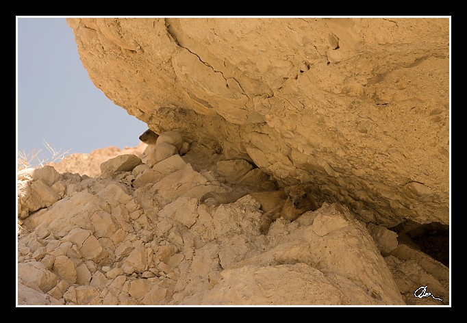
| Tady se damani schovávají ve stínu skal - mají horší termoregulaci ... |
|
| 3 GPS 24. 06. 2010 12:16:38, Izrael - En Gedi, 1/60 sec, f 7.1, ISO 200 , 50 mm, Blesk No Flash |
Cesta
2010/06 cerven/24 Qumran, En Gedi a Wadi Quelt/20100624-035.jpgContains Exchangeable Image File Format (EXIF) Information
Main Image Information
| Image Width | 682 pixels |
| Image Length | 472 pixels |
| Compression | Uncompressed |
| Photometric Interpretation | RGB (Red Green Blue) |
| Make (Manufacturer) | Canon |
| Model | Canon EOS 40D |
| X Resolution | 1207959552/16777216 (72) pixels per 'Resolution Unit' |
| Y Resolution | 1207959552/16777216 (72) pixels per 'Resolution Unit' |
| Planar Configuration | Chunky Format |
| Resolution Unit | Inches |
| Date and Time | 2010:07:03 17:41:40 (Format: YYYY:MM:DD HH:mm:SS) |
| YCbCr Positioning | Chrominance components Centred in relation to luminance components |
EXIF Image File Directory (IFD) contents
| Exposure Time | 1/60 (0.016666666666667) seconds |
| Aperture F Number | 71/10 (7.1) |
| Exposure Program | Aperture priority |
| ISO Speed Ratings | 200 |
| Exif Version | 0221 |
| Date and Time of Original | 2010:06:24 12:16:38 |
| Date and Time when Digitized | 2010:06:24 12:16:38 |
| APEX Shutter Speed Value (Tv) | 5906891/1000000 (5.906891) |
| APEX Aperture Value (Av) | 5655638/1000000 (5.655638) |
| APEX Exposure Bias Value (Exposure Compensation) | 0/1 (0) EV |
| Metering Mode | Pattern |
| Flash | Flash did not fire, compulsory flash suppression mode |
| FocalLength | 50/1 (50) mm |
| Sub Second Time of Original | 59 |
| Sub Second Time when Digitized | 59 |
| Focal Plane X Resolution | 3888000/876 (4438.3561643836) pixels per 'Focal Plane Resolution Unit' |
| Focal Plane Y Resolution | 2592000/583 (4445.9691252144) pixels per 'Focal Plane Resolution Unit' |
| Focal Plane Resolution Unit | Inches |
| Special Processing (Custom Rendered) | Normal process |
| Exposure Mode | Auto exposure |
| White Balance | Manual white balance |
| Scene Capture Type | Standard |
| Pixel X Dimension | 682 pixels |
| Pixel Y Dimension | 472 pixels |
| Colour Space | Uncalibrated |
| Components Configuration | Component 1: Y (Luminance) Component 2: Cb (Chroma minus Blue) Component 3: Cr (Chroma minus Red) Component 4: Does not exist |
| User Comment |
GPS Info Image File Directory (IFD) contents
| Longitude | 35/1 (35), 2362068/100000 (23.62068), 0/0 (Degrees Minutes Seconds East or West) |
| East or West Longitude | E |
| Latitude | 31/1 (31), 2803927/100000 (28.03927), 0/0 (Degrees Minutes Seconds North or South) |
| North or South Latitude | N |
| Altitude | 368530/1000 (368.53) Metres with respect to Altitude Reference |
| Altitude Reference | Sea level reference (negative value) |
Contains Extensible Metadata Platform (XMP) / Resource Description Framework (RDF) Information
Dublin Core Metadata Initiative RDF Segment
| Creator(s) (Authors): | Ordered List: Ing. Daniel Žingor |
| Rights Statement: | List of Alternates: © Daniel Žingor |
| Description (Caption): | List of Alternates: Tady se damani schovávají ve stínu skal - mají horší termoregulaci ... |
| Subject and Keywords: | Unordered List: Reportáž Krajina Zvířata Web |
XMP - embedded TIFF Segment
| Make: | Canon |
| Model: | Canon EOS 40D |
| Image Width: | 3888 |
| Image Length: | 2592 |
| Samples Per Pixel: | 3 |
| Bits Per Sample: | Ordered List: 16 16 16 |
| Photometric Interpretation: | 2 |
XMP - embedded EXIF Segment
| Exif Version: | 0221 |
| Exposure Time: | 1/60 |
| Shutter Speed Value: | 5906891/1000000 |
| F Number: | 71/10 |
| Aperture Value: | 5655638/1000000 |
| Exposure Program: | 3 |
| Date & Time of Original: | 2010-06-24T12:16:38.59+02:00 |
| Date & Time Digitized: | 2010-06-24T12:16:38.59+02:00 |
| Exposure Bias Value: | 0/1 |
| Metering Mode: | 5 |
| Focal Length: | 50/1 |
| Custom Rendered: | 0 |
| Exposure Mode: | 0 |
| White Balance: | 1 |
| Scene Capture Type: | 0 |
| Focal Plane X Resolution: | 3888000/876 |
| Focal Plane Y Resolution: | 2592000/583 |
| Focal Plane Resolution Unit: | 2 |
| ISO Speed Ratings: | Ordered List: 200 |
| Flash: | Fired = False Return = 0 Mode = 2 Function = False Red Eye Mode = False |
| Pixel X Dimension: | 3888 |
| Pixel Y Dimension: | 2592 |
| GPS Longitude: | 35,23.620680E |
| GPS Latitude: | 31,28.039270N |
| GPS Altitude: | 368530/1000 |
| GPS Altitude Reference: | 1 |
XMP Basic Segment
| Resource Last Modify Date: | 2010-06-24T22:00:25+02:00 |
| Original Creation Date: | 2010-06-24T12:16:38.59+02:00 |
| Unknown field xap:Rating: | 3 |
| Unknown field xap:Label: | Green |
Unknown RDF Segment 'aux'
| Unknown field aux:Lens: | 17.00 - 50.00 mm |
| Unknown field aux:Firmware: | Firmware Version 1.0.3 |
Photoshop RDF Segment
| Unknown field photoshop:LegacyIPTCDigest: | EA20940AFBF52D322CB867DF2CB70E1C |
Unknown RDF Segment 'znr'
| Unknown field znr:RawDevelopSettings: | UEsDBBQAAAAIAAmw2Dy1OLN3vAIAAF4JAAAMAAAAc2V0dGluZ3MueG1sbZZLbtwwDIb3BXqTTup5 Bg0CAUG7L9B1NorMGQuRJYOSJ51crYseqVeobFNPZ1bix5+URdH0/Pvz9/Ed3x5auIIyA/v8aTaf FAJvb0/DoCS0bPv49QNKWoti4K5jPx6eW/M69qDd7fnnC/L319vzrtk2m+a02R3mZXPaHTbN/nj3 /dduyRmiKRlHJ89cuLNUDpCRqKKkVfLSOcuaRUNWeKiOt+YtOoNJXmG0Q25dcEc7+BVH6W7RTSZ5 HfQDIHcjAjvd74+LKKchDe9zGrKVNCSV2rHNPeWajCzJZGbRmddOSbiTRjNfXTpsYqS6Sn8dWkDS REKKbozPNy2Jvr0E6FfEzgZ77th+4WSRr4XeWC5FiIp2rLsyaAcuUjESCfmlAt+I1HJkkW+0vXUI +uIb5kQZcpZkyFs5Wra92yUZsSRyHYLtjGpDnxUs6dTYG61u4ZkyQhr4PQjTD6y5C/UNhAQafUQ4 82JEjy9B8kxGamEcNNi8iQmEcouBUaFF3Mo3srbTtYSwBEiBxnEH88OShEi4JTQDgnCLwv++xMW2 XtAthojYB9bNb3VoAzJTCwloNe+BxS4KoHi3XbiLQ/GSu+qK6O1eqWte5H5RoFsr34HdF8kTL7Ov 9StHlX/EVvojTRNrX22RuepdPoj6yFfs5QcCaDuNqMMx3yjxcpe1fuUo8sOV7YoLj7jMu9IlHrrT aBAjXsPNJ7sYEZ08O5ZPiBmQ5IL8hv77E8oT7Mx9QQDNjt+SYCGZxFfTz8NtUswgCsw4+HfY2GlE R1EOc6WfjrkmDcvZnE9QCBay0iynbGphdXiP0yTIs67mw0xThXPtqu4z1UZa8KUcxfJFyQIqV7FD HDDFDvXYoQPpK6Cts2e4UPtmRz6gmT4DZUDhyWO6Fss/BhWttNUfhRrn6qlJrOAKCnGiXvu1/C/1 H1BLAQIAABQAAAAIAAmw2Dy1OLN3vAIAAF4JAAAMAAAAAAAAAAEAIAAAAAAAAABzZXR0aW5ncy54 bWxQSwUGAAAAAAEAAQA6AAAA5gIAAAAA |
Unknown RDF Segment 'Iptc4xmpCore'
| Unknown field Iptc4xmpCore:Location: | Izrael - En Gedi |
