| No jestli bych toto měl vidět jako zemi oplývající medem a mlékem :) to asi ne ... |
|
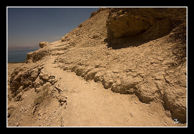
| 3 GPS 24. 06. 2010 13:05:49, Izrael - En Gedi, 1/320 sec, f 13, ISO 100 , 10 mm, Blesk No Flash |
Cesta
2010/06 cerven/24 Qumran, En Gedi a Wadi Quelt/20100624-069.jpgContains Exchangeable Image File Format (EXIF) Information
Main Image Information
| Image Width | 682 pixels |
| Image Length | 472 pixels |
| Compression | Uncompressed |
| Photometric Interpretation | RGB (Red Green Blue) |
| Make (Manufacturer) | Canon |
| Model | Canon EOS 40D |
| X Resolution | 1207959552/16777216 (72) pixels per 'Resolution Unit' |
| Y Resolution | 1207959552/16777216 (72) pixels per 'Resolution Unit' |
| Planar Configuration | Chunky Format |
| Resolution Unit | Inches |
| Date and Time | 2010:07:03 17:41:53 (Format: YYYY:MM:DD HH:mm:SS) |
| YCbCr Positioning | Chrominance components Centred in relation to luminance components |
EXIF Image File Directory (IFD) contents
| Exposure Time | 1/320 (0.003125) seconds |
| Aperture F Number | 13/1 (13) |
| Exposure Program | Aperture priority |
| ISO Speed Ratings | 100 |
| Exif Version | 0221 |
| Date and Time of Original | 2010:06:24 13:05:49 |
| Date and Time when Digitized | 2010:06:24 13:05:49 |
| APEX Shutter Speed Value (Tv) | 8321928/1000000 (8.321928) |
| APEX Aperture Value (Av) | 7400879/1000000 (7.400879) |
| APEX Exposure Bias Value (Exposure Compensation) | 0/1 (0) EV |
| Metering Mode | Pattern |
| Flash | Flash did not fire, compulsory flash suppression mode |
| FocalLength | 10/1 (10) mm |
| Sub Second Time of Original | 01 |
| Sub Second Time when Digitized | 01 |
| Focal Plane X Resolution | 3888000/876 (4438.3561643836) pixels per 'Focal Plane Resolution Unit' |
| Focal Plane Y Resolution | 2592000/583 (4445.9691252144) pixels per 'Focal Plane Resolution Unit' |
| Focal Plane Resolution Unit | Inches |
| Special Processing (Custom Rendered) | Normal process |
| Exposure Mode | Auto exposure |
| White Balance | Manual white balance |
| Scene Capture Type | Standard |
| Pixel X Dimension | 682 pixels |
| Pixel Y Dimension | 472 pixels |
| Colour Space | Uncalibrated |
| Components Configuration | Component 1: Y (Luminance) Component 2: Cb (Chroma minus Blue) Component 3: Cr (Chroma minus Red) Component 4: Does not exist |
| User Comment |
GPS Info Image File Directory (IFD) contents
| Longitude | 35/1 (35), 2398507/100000 (23.98507), 0/0 (Degrees Minutes Seconds East or West) |
| East or West Longitude | E |
| Latitude | 31/1 (31), 2752398/100000 (27.52398), 0/0 (Degrees Minutes Seconds North or South) |
| North or South Latitude | N |
| Altitude | 417070/1000 (417.07) Metres with respect to Altitude Reference |
| Altitude Reference | Sea level reference (negative value) |
Contains Extensible Metadata Platform (XMP) / Resource Description Framework (RDF) Information
Dublin Core Metadata Initiative RDF Segment
| Creator(s) (Authors): | Ordered List: Ing. Daniel Žingor |
| Rights Statement: | List of Alternates: © Daniel Žingor |
| Description (Caption): | List of Alternates: No jestli bych toto měl vidět jako zemi oplývající medem a mlékem :) to asi ne ... |
| Subject and Keywords: | Unordered List: Reportáž Web |
XMP - embedded TIFF Segment
| Make: | Canon |
| Model: | Canon EOS 40D |
| Image Width: | 3888 |
| Image Length: | 2592 |
| Samples Per Pixel: | 3 |
| Bits Per Sample: | Ordered List: 16 16 16 |
| Photometric Interpretation: | 2 |
XMP - embedded EXIF Segment
| Exif Version: | 0221 |
| Exposure Time: | 1/320 |
| Shutter Speed Value: | 8321928/1000000 |
| F Number: | 13/1 |
| Aperture Value: | 7400879/1000000 |
| Exposure Program: | 3 |
| Date & Time of Original: | 2010-06-24T13:05:49.01+02:00 |
| Date & Time Digitized: | 2010-06-24T13:05:49.01+02:00 |
| Exposure Bias Value: | 0/1 |
| Metering Mode: | 5 |
| Focal Length: | 10/1 |
| Custom Rendered: | 0 |
| Exposure Mode: | 0 |
| White Balance: | 1 |
| Scene Capture Type: | 0 |
| Focal Plane X Resolution: | 3888000/876 |
| Focal Plane Y Resolution: | 2592000/583 |
| Focal Plane Resolution Unit: | 2 |
| ISO Speed Ratings: | Ordered List: 100 |
| Flash: | Fired = False Return = 0 Mode = 2 Function = False Red Eye Mode = False |
| Pixel X Dimension: | 3888 |
| Pixel Y Dimension: | 2592 |
| GPS Longitude: | 35,23.985069E |
| GPS Latitude: | 31,27.523979N |
| GPS Altitude: | 417070/1000 |
| GPS Altitude Reference: | 1 |
XMP Basic Segment
| Resource Last Modify Date: | 2010-06-24T22:08:51+02:00 |
| Original Creation Date: | 2010-06-24T13:05:49.01+02:00 |
| Unknown field xap:Rating: | 3 |
| Unknown field xap:Label: | Green |
Unknown RDF Segment 'aux'
| Unknown field aux:Lens: | 10.00 - 20.00 mm |
| Unknown field aux:Firmware: | Firmware Version 1.0.3 |
Photoshop RDF Segment
| Unknown field photoshop:LegacyIPTCDigest: | EA20940AFBF52D322CB867DF2CB70E1C |
Unknown RDF Segment 'znr'
| Unknown field znr:RawDevelopSettings: | UEsDBBQAAAAIABax2DxECrnB0gIAAKIJAAAMAAAAc2V0dGluZ3MueG1sbZbNbtswDMfvA/Ym/Ujc JEWLQkDR3Qfs3IsqM7FQWxIkOV36ajvskfYKk21SX25O4p8/UhZF0/n35+/Tp/14bOEMvTbs+7fZ fO4t8PbybEwvoWXbp9svVGSdFYb7jv14fG31+ziA8pfXn2+Wf75fXpvNdnO9OVw3u3m5OTS7YD7c vPxqlpwUjcm49fLIhT/K3oNlCFUqsr08dd6xzcKgRQ/V8VZ/RCeZ6BVaecudJ3e0yd9zK/0lutFE r4fBgOV+tMAO93f7BcpVSsOHXKVspUpJpfLs+h5zTUaWZDKz6MzrpiTcS61YqC4eNmlInWW4DiUg MVFBohvj801LVD/eSAwr1I7aDtyzu0VHC30tDNpxKSgq2rHuvbbOcJGKkRTKL3sIjYgthxb6Rjc4 b0GdQsMcMEOuJczyVo6ObW+ahKGWIN9ZcJ3uW+qzQktcPw5a9Rd6pkxBBn4boQfDNjdUX1IQUDZE 0JkXI3pCCZJnMlILW6PA5U2MApVbGIaFFnGr0MjKTddCYUlAwmrPPcwPiwgqdEtWGwvCL0T4XcXF tl7gLVJE7APn57ea2gDN1EICWsUHYLGLSCjebU93sStecl9dEb7dK7rWi9xvPajWyU9g90XypJfZ 1/zKUeUfbSvDkaaJdVdtkbnqXb6I+spX7BUGAig3jajdPt8o6eUua37lKPLDmTXFhUe5zLvikk7d qRWI0Z7Dzc+mMHoeblfUrCgQjmaz3V01+/2KuS1zFmOmk0fP8ikzC4icLL/Y8A2jEpOduU8WQLH9 QwIWJUPCjYSZuk3ELERAjybMAe2mMR+hXMzJMGFzJg3c2ZxPUACLsmKWU25qsDp8kNM0ybOuZsys pgrn7Krus6q0dBBKOYrlq5QFVK5ihzikih3q0YUHUmewrs6eyQUdXhjLjdXTp6QMKDx5TNfa8s9F pVZs9WejlnN6ahIneA8FnFTq6fR/7D9QSwECAAAUAAAACAAWsdg8RAq5wdICAACiCQAADAAAAAAA AAABACAAAAAAAAAAc2V0dGluZ3MueG1sUEsFBgAAAAABAAEAOgAAAPwCAAAAAA== |
Unknown RDF Segment 'Iptc4xmpCore'
| Unknown field Iptc4xmpCore:Location: | Izrael - En Gedi |
