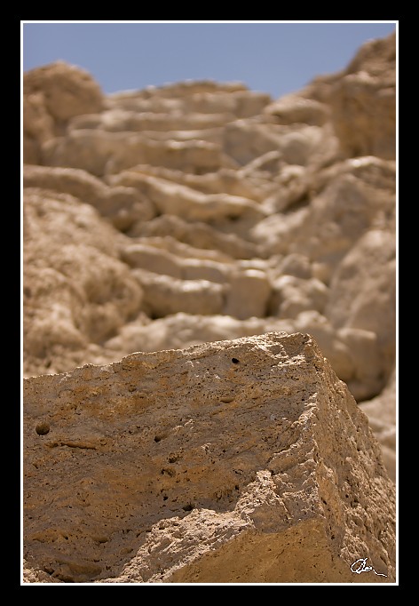
| Schody poněkud znejistily moje prvotní přesvědčení že šlo o prvovýstup ... |
|
| 2 GPS 24. 06. 2010 13:12:36, Izrael - En Gedi, 1/2000 sec, f 2.8, ISO 100 , 70 mm, Blesk No Flash |
Cesta
2010/06 cerven/24 Qumran, En Gedi a Wadi Quelt/20100624-075.jpgContains Exchangeable Image File Format (EXIF) Information
Main Image Information
| Image Width | 472 pixels |
| Image Length | 682 pixels |
| Compression | Uncompressed |
| Photometric Interpretation | RGB (Red Green Blue) |
| Make (Manufacturer) | Canon |
| Model | Canon EOS 40D |
| X Resolution | 1207959552/16777216 (72) pixels per 'Resolution Unit' |
| Y Resolution | 1207959552/16777216 (72) pixels per 'Resolution Unit' |
| Planar Configuration | Chunky Format |
| Resolution Unit | Inches |
| Date and Time | 2010:07:03 17:42:26 (Format: YYYY:MM:DD HH:mm:SS) |
| YCbCr Positioning | Chrominance components Centred in relation to luminance components |
EXIF Image File Directory (IFD) contents
| Exposure Time | 1/2000 (0.0005) seconds |
| Aperture F Number | 28/10 (2.8) |
| Exposure Program | Aperture priority |
| ISO Speed Ratings | 100 |
| Exif Version | 0221 |
| Date and Time of Original | 2010:06:24 13:12:36 |
| Date and Time when Digitized | 2010:06:24 13:12:36 |
| APEX Shutter Speed Value (Tv) | 10965784/1000000 (10.965784) |
| APEX Aperture Value (Av) | 2970854/1000000 (2.970854) |
| APEX Exposure Bias Value (Exposure Compensation) | 0/1 (0) EV |
| Metering Mode | Pattern |
| Flash | Flash did not fire, compulsory flash suppression mode |
| FocalLength | 70/1 (70) mm |
| Sub Second Time of Original | 01 |
| Sub Second Time when Digitized | 01 |
| Focal Plane X Resolution | 3888000/876 (4438.3561643836) pixels per 'Focal Plane Resolution Unit' |
| Focal Plane Y Resolution | 2592000/583 (4445.9691252144) pixels per 'Focal Plane Resolution Unit' |
| Focal Plane Resolution Unit | Inches |
| Special Processing (Custom Rendered) | Normal process |
| Exposure Mode | Auto exposure |
| White Balance | Manual white balance |
| Scene Capture Type | Standard |
| Pixel X Dimension | 472 pixels |
| Pixel Y Dimension | 682 pixels |
| Colour Space | Uncalibrated |
| Components Configuration | Component 1: Y (Luminance) Component 2: Cb (Chroma minus Blue) Component 3: Cr (Chroma minus Red) Component 4: Does not exist |
| User Comment |
GPS Info Image File Directory (IFD) contents
| Longitude | 35/1 (35), 2397870/100000 (23.9787), 0/0 (Degrees Minutes Seconds East or West) |
| East or West Longitude | E |
| Latitude | 31/1 (31), 2751810/100000 (27.5181), 0/0 (Degrees Minutes Seconds North or South) |
| North or South Latitude | N |
| Altitude | 413230/1000 (413.23) Metres with respect to Altitude Reference |
| Altitude Reference | Sea level reference (negative value) |
Contains Extensible Metadata Platform (XMP) / Resource Description Framework (RDF) Information
Dublin Core Metadata Initiative RDF Segment
| Creator(s) (Authors): | Ordered List: Ing. Daniel Žingor |
| Rights Statement: | List of Alternates: © Daniel Žingor |
| Description (Caption): | List of Alternates: Schody poněkud znejistily moje prvotní přesvědčení že šlo o prvovýstup ... |
| Subject and Keywords: | Unordered List: Reportáž Krajina Web |
XMP - embedded TIFF Segment
| Make: | Canon |
| Model: | Canon EOS 40D |
| Image Width: | 2592 |
| Image Length: | 3888 |
| Samples Per Pixel: | 3 |
| Bits Per Sample: | Ordered List: 16 16 16 |
| Photometric Interpretation: | 2 |
XMP - embedded EXIF Segment
| Exif Version: | 0221 |
| Exposure Time: | 1/2000 |
| Shutter Speed Value: | 10965784/1000000 |
| F Number: | 28/10 |
| Aperture Value: | 2970854/1000000 |
| Exposure Program: | 3 |
| Date & Time of Original: | 2010-06-24T13:12:36.01+02:00 |
| Date & Time Digitized: | 2010-06-24T13:12:36.01+02:00 |
| Exposure Bias Value: | 0/1 |
| Metering Mode: | 5 |
| Focal Length: | 70/1 |
| Custom Rendered: | 0 |
| Exposure Mode: | 0 |
| White Balance: | 1 |
| Scene Capture Type: | 0 |
| Focal Plane X Resolution: | 3888000/876 |
| Focal Plane Y Resolution: | 2592000/583 |
| Focal Plane Resolution Unit: | 2 |
| ISO Speed Ratings: | Ordered List: 100 |
| Flash: | Fired = False Return = 0 Mode = 2 Function = False Red Eye Mode = False |
| Pixel X Dimension: | 2592 |
| Pixel Y Dimension: | 3888 |
| GPS Longitude: | 35,23.978701E |
| GPS Latitude: | 31,27.518101N |
| GPS Altitude: | 413230/1000 |
| GPS Altitude Reference: | 1 |
XMP Basic Segment
| Resource Last Modify Date: | 2010-06-24T22:10:20+02:00 |
| Original Creation Date: | 2010-06-24T13:12:36.01+02:00 |
| Unknown field xap:Rating: | 2 |
| Unknown field xap:Label: | Green |
Unknown RDF Segment 'aux'
| Unknown field aux:Lens: | 70.00 - 200.00 mm |
| Unknown field aux:Firmware: | Firmware Version 1.0.3 |
Photoshop RDF Segment
| Unknown field photoshop:LegacyIPTCDigest: | EA20940AFBF52D322CB867DF2CB70E1C |
Unknown RDF Segment 'znr'
| Unknown field znr:RawDevelopSettings: | UEsDBBQAAAAIAEex2Dw5Q4g2vQIAAF4JAAAMAAAAc2V0dGluZ3MueG1sbZbNbtswDMfvA/YmS+ek +cCKQkCx3Qfs3IsqM7FQWTIoOV36ajvskfYKk23q081J/PFPyqJoOv/+/H18x7eHFq6gzMA+f5rN J4XA29vTMCgJLds+fv2AktaiGLjr2I+H59a8jj1od3v++YL8/fX2vGu2zaY5bnb7edkcd/tNczrc ff+1W3KGaErG0ckzF+4slQNkJKooaZW8dM6yZtGQFR6q4615i85gklcY7ZBbF9zRDn7FUbpbdJNJ Xgf9AMjdiMCOp/vDIsppSMP7nIZsJQ1JpXZsc6Jck5ElmcwsOvPaKQl30mjmq0uHTYxUV+mvQwtI mkhI0Y3x+aYl0beXAP2K2Nlgzx27XzhZ5GuhN5ZLEaKiHeuuDNqBi1SMREJ+qcA3IrUcWeQbbW8d gr74hjlShpwlGfJWjpZt73ZJRiyJXIdgO6Pa0GcFSzo19karW3imjJAGfg/C9ANr7kJ9AyGBRh8R zrwY0eNLkDyTkVoYBw02b2ICodxiYFRoEbfyjaztdC0hLAFSoHHcwfywJCESbgnNgCDcovC/L3Gx rRd0iyEi9oF181sd2oDM1EICWs17YLGLAijebRfuYl+85K66Inq7V+qaF7lfFOjWyndgpyJ54mX2 tX7lqPKP2Ep/pGli3VdbZK56lw+iPvIVe/mBANpOI2p/yDdKvNxlrV85ivxwZbviwiMu8650iYfu NBrEiNdw88kuRkQnz47lE2IGJLkgv6H//oTyBDtzXxBAs8O3JFhIJvHV9PNwmxQziAIzDv4dNnYa 0VGUw1zpp2OuScNyNucTFIKFrDTLKZtaWB3e4zQJ8qyr+TDTVOFcu6r7TLWRFnwpR7F8UbKAylXs EAdMsUM9duhA+gpo6+wZLtS+2ZEPaKbPQBlQePKYrsXyj0FFK231R6HGuXpqEiu4gkKcqNd+Lf9L /QdQSwECAAAUAAAACABHsdg8OUOINr0CAABeCQAADAAAAAAAAAABACAAAAAAAAAAc2V0dGluZ3Mu eG1sUEsFBgAAAAABAAEAOgAAAOcCAAAAAA== |
Unknown RDF Segment 'Iptc4xmpCore'
| Unknown field Iptc4xmpCore:Location: | Izrael - En Gedi |
