| Organizační dohody ... |
|
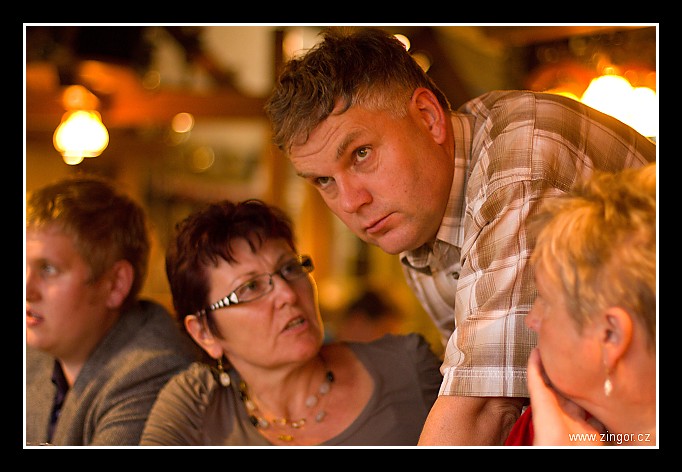
| 3 GPS 16. 09. 2011 18:32:35, Německo - Hochst, 1/80 sec, f 1.4, ISO 800 , 50 mm, Blesk No Flash |
Cesta
2011/09 zari/16 - pa Nemecko 2011/20110916-050.jpgContains Exchangeable Image File Format (EXIF) Information
Main Image Information
| Image Width | 682 pixels |
| Image Length | 472 pixels |
| Compression | Uncompressed |
| Photometric Interpretation | RGB (Red Green Blue) |
| Make (Manufacturer) | Canon |
| Model | Canon EOS 7D |
| X Resolution | 1207959552/16777216 (72) pixels per 'Resolution Unit' |
| Y Resolution | 1207959552/16777216 (72) pixels per 'Resolution Unit' |
| Planar Configuration | Chunky Format |
| Resolution Unit | Inches |
| Date and Time | 2011:09:25 18:09:17 (Format: YYYY:MM:DD HH:mm:SS) |
| YCbCr Positioning | Chrominance components Centred in relation to luminance components |
EXIF Image File Directory (IFD) contents
| Exposure Time | 1/80 (0.0125) seconds |
| Aperture F Number | 14/10 (1.4) |
| Exposure Program | Aperture priority |
| ISO Speed Ratings | 800 |
| Exif Version | 0221 |
| Date and Time of Original | 2011:09:16 18:32:35 |
| Date and Time when Digitized | 2011:09:16 18:32:35 |
| APEX Shutter Speed Value (Tv) | 6321928/1000000 (6.321928) |
| APEX Aperture Value (Av) | 970854/1000000 (0.970854) |
| APEX Exposure Bias Value (Exposure Compensation) | -1/3 (-0.33333333333333) EV |
| Metering Mode | Center Weighted Average |
| Flash | Flash did not fire, compulsory flash suppression mode |
| FocalLength | 50/1 (50) mm |
| Sub Second Time of Original | 86 |
| Sub Second Time when Digitized | 86 |
| Focal Plane X Resolution | 5184000/907 (5715.545755237) pixels per 'Focal Plane Resolution Unit' |
| Focal Plane Y Resolution | 3456000/595 (5808.4033613445) pixels per 'Focal Plane Resolution Unit' |
| Focal Plane Resolution Unit | Inches |
| Special Processing (Custom Rendered) | Normal process |
| Exposure Mode | Auto exposure |
| White Balance | Manual white balance |
| Scene Capture Type | Standard |
| Pixel X Dimension | 682 pixels |
| Pixel Y Dimension | 472 pixels |
| Colour Space | Uncalibrated |
| Components Configuration | Component 1: Y (Luminance) Component 2: Cb (Chroma minus Blue) Component 3: Cr (Chroma minus Red) Component 4: Does not exist |
| User Comment |
GPS Info Image File Directory (IFD) contents
| North or South Latitude | N |
| Latitude | 49/1 (49), 482681/10000 (48.2681), 0/0 (Degrees Minutes Seconds North or South) |
| East or West Longitude | E |
| Longitude | 8/1 (8), 592622/10000 (59.2622), 0/0 (Degrees Minutes Seconds East or West) |
| Altitude Reference | Sea Level |
| Altitude | 179900/1000 (179.9) Metres with respect to Altitude Reference |
Contains Extensible Metadata Platform (XMP) / Resource Description Framework (RDF) Information
Dublin Core Metadata Initiative RDF Segment
| Creator(s) (Authors): | Ordered List: Ing. Daniel Žingor |
| Rights Statement: | List of Alternates: © Daniel Žingor |
| Subject and Keywords: | Unordered List: Reportáž Web Portrét |
| Description (Caption): | List of Alternates: Organizační dohody ... |
XMP - embedded EXIF Segment
| GPS Longitude: | 8,59.2622E |
| GPS Latitude: | 49,48.2681N |
| GPS Altitude: | 179900/1000 |
| GPS Altitude Reference: | 0 |
| Exif Version: | 0221 |
| Exposure Time: | 1/80 |
| Shutter Speed Value: | 6321928/1000000 |
| F Number: | 14/10 |
| Aperture Value: | 970854/1000000 |
| Exposure Program: | 3 |
| Date & Time of Original: | 2011-09-16T18:32:35.86+02:00 |
| Date & Time Digitized: | 2011-09-16T18:32:35.86+02:00 |
| Exposure Bias Value: | -1/3 |
| Metering Mode: | 2 |
| Focal Length: | 50/1 |
| Custom Rendered: | 0 |
| Exposure Mode: | 0 |
| White Balance: | 1 |
| Scene Capture Type: | 0 |
| Focal Plane X Resolution: | 5184000/907 |
| Focal Plane Y Resolution: | 3456000/595 |
| Focal Plane Resolution Unit: | 2 |
| ISO Speed Ratings: | Ordered List: 800 |
| Flash: | Fired = False Return = 0 Mode = 2 Function = False Red Eye Mode = False |
| Pixel X Dimension: | 5184 |
| Pixel Y Dimension: | 3456 |
XMP - embedded TIFF Segment
| Make: | Canon |
| Model: | Canon EOS 7D |
| Image Width: | 5184 |
| Image Length: | 3456 |
| Samples Per Pixel: | 3 |
| Bits Per Sample: | Ordered List: 16 16 16 |
| Photometric Interpretation: | 2 |
XMP Basic Segment
| Resource Last Modify Date: | 2011-09-17T08:04:13+02:00 |
| Original Creation Date: | 2011-09-16T18:32:35.86+02:00 |
| Unknown field xap:Label: | Green |
| Unknown field xap:Rating: | 3 |
Unknown RDF Segment 'aux'
| Unknown field aux:Lens: | 50.00 mm |
| Unknown field aux:Firmware: | Firmware Version 1.2.2 |
Photoshop RDF Segment
| Unknown field photoshop:LegacyIPTCDigest: | EA20940AFBF52D322CB867DF2CB70E1C |
Unknown RDF Segment 'znr'
| Unknown field znr:RawDevelopSettings: | UEsDBBQAAAAIAAAAIAADIE0MCQMAAH8KAAAMAAAAc2V0dGluZ3MueG1sdVbLbtswELwX6J80qeTE bhMEBIKm96JAe/KFEdcWAYkUSMqJ82s99JP6C6WkXb7k+MSdGS6p5XLMf3/+PryZl3sBJ+j0wD5+ mMPv6igV/AZjpVasfvi8BlH52Bng4vw4DJ0EQdICRa01zcBdy57u97+sT7N/4mr/QzZuNGD3m6qu r6q7q3o3D6u7endVbavrbz83S1Kajtm4cfLAG3eQnQPDUFSgqO3ksXWWVYsGI9pVy4V+CSSFyDZa OcOtIzrExHfcSHcONIbIOugHMHz6QLartyhKUUrD+xSlbDlKSaVybEO5piBJMoXJ7IS1UxLu5gOt 6GMjhqqTfDZcNRA1AUFFO4b9TUNEX57Z1wX0I8QO2vTcsZsFx4h2I99AitdQdQyRFdBry2VDdIjD qXTa2IE3sVQRodVlB76jsSMxQm60vXUG1NG30w4zpFiUGS7kaFl9vYkyxKLItb6BW90J6sIMi7pu 7LXqzrSnBEENvA6N7gdWXVP1CUGBMn4GffMSBMaXIDJTEBvcDAps2uIIULmbgWGhm7CUb3Nlp0Oj aRFAhdGOO5g3ixJE6JSMHgw0blH436cwqMsBniLNCH1g3XznqQ0wjA3WgFC8BxZ6jACquhJgfBG1 9TeoB9dqQd9zicr8wtEJhrtQ4LmDBPg2t5JSviR57kCJqe3Zlyx5xPPsa/2KKPKPRkhfickGb4ol Eqpc5cKsS1y2lncZUHbyvdttulDE81XW+hWR5YcT22R9EuA870oXcWpqraAZzYkaJsaZs7Ty4Fhq LDOAkqPhZ+P/1ag8FCf00QAotr2LggVJJL6a3mTrqJiB4MJHBc6795H3elTxBpElF/RqWi/FoCfz 3743MyjCnvQ40G1gYV8pmCq9y6eaaPpzOBctEyzISrMUtiqFRb09HD0rzbpyshmNh5pqV0c9o0pL /xQBMTYueepcorIVghVmK5QGiR+kTvlDqoQztb9fhg9GT39Y+YSMSee0wuQPnAIttMWDp4RT9dSX tuEdZOKIptrYWtm2E9ir0cbpsfkfUEsBAgAAFAAAAAgAAAAgAAMgTQwJAwAAfwoAAAwAAAAAAAAA AQAAAAAAAAAAAHNldHRpbmdzLnhtbFBLBQYAAAAAAQABADoAAAAzAwAAAAA= |
Unknown RDF Segment 'Iptc4xmpCore'
| Unknown field Iptc4xmpCore:Location: | Německo - Hochst |
